
Cluster of Flow Pathway Barriers
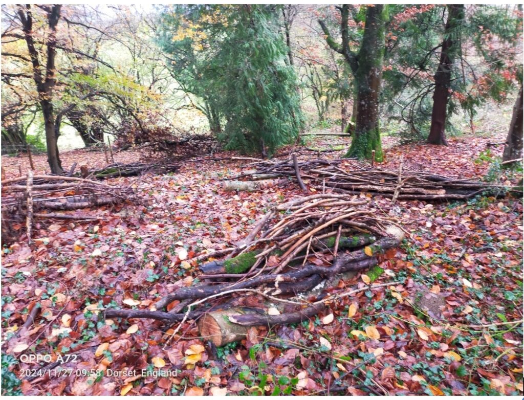
A total of 60 flow pathway barriers have been installed across the site. This exceeds the 54 planned in the initial proposal. The barriers immediately below the highway are already intercepting and dispersing surface water flows as evidenced by the accumulation of sediment against some of the barriers. The woody barriers also provide new micro-habitats for invertebrates.
Wood arisings habitat bank

Three habitat banks have been created, one near each pond and scrape (where a ‘scallop’ shape is made in the ground). Habit banks are organised piles of woody material and the one near the south side of the ride is topped with soil which makes it suitable for the establishment of woodland/chalk grassland plants through seeding and/or plug planting. Hopefully, these banks will provide suitable refuge and hibernation sites for amphibians, reptiles and invertebrates as well as habitat for fungi and other saproxylic animals and plants. Unfortunately, the other two banks could not be topped with soil as planned due to the lack of spoil arisings and the very flinty nature of the spoil which made this material unsuitable. However, they will still be great habitats for a range of invertebrates, fungi, small mammals and plants.
Grips are simple angled trenches dug in the bank or verge to drain a highway. Four of the five original highway grips have been successfully enhanced, i.e. widened, and lowered to just below the road surface and a terminal swale (pond) has been excavated at the end of each grip to attenuate runoff flows. The top-most grip could not be enhanced due to the proximity of a telegraph pole cable stay to the grip and the risk of damaging this and the associated pole. As an alternative, a new grip was excavated at the downhill end of the site. The amount of surface water runoff flowing down from Gore Hill is significant. The volume and velocity of the runoff is so substantial that it shifts large quantities of sediment, a large proportion of which has been deposited in the terminal swale of the top most grip. This swale will be used to take sediment samples to monitor for phosphate as well as sampling any standing water to measure phosphate levels in the water column. The grips were evaluated on the 6/01/25 after heavy rainfall in the previous few days. It was assessed that up to 3 further Flow Pathway Barriers (FPBs) were needed to limit erosion of the features and slow water flow down the escarpment below these grips.
Pond south of ride

Two flow paths were identified in October/November 2024 which were causing scour on the footpath with the loss of scalpings. Flow pathway barriers were installed on these pathways and appeared to be functioning well on the visit on the 6/01/25 with no further scour noted.
Highways grip with terminal swale

A mid-slope scrape is functioning well as an infiltration pond as planned and the pond on the south side of the ride was holding a good quantity of water. It is likely that water from the scrape is contributing to this pond. The pond now provides a new aquatic habitat. This is likely to be of a seasonal nature, but valuable nevertheless. This pond habitat can be further developed with aquatic and marginal planting and monitoring the natural colonisation of the pond by fauna would be a worthwhile exercise. Monitoring phosphate levels has shown values of around 0.22 mg/l which is high. Monitoring phosphate will help identify if these levels are natural or anthropogenic (human made) in origin. Unfortunately, the clay substrate in a new pond on the north side of the ride was much thinner than anticipated and the base of the pond is now within the fractured chalk/flint geological layer. This is very positive for infiltration to groundwater but does not meet our objective of creating another permanent/semi-permanent pond habitat. This could be remedied by lining the deeper section and part of the shallow area with clay to retain water which could be done in a future phase of works.
Initial evaluation of the features suggests that most of the project objectives have been met with the exceptions already noted above which only require modest adjustments/additions. Ongoing monitoring and evaluation of the hydrological and ecological performance of the interventions will provide valuable data for stakeholders and opportunities for volunteer participation.
Lorne Thomson, YRCT/ WRIG
Quinton Deeley, WRIG